EPHA – European prehistoric and historic atlas
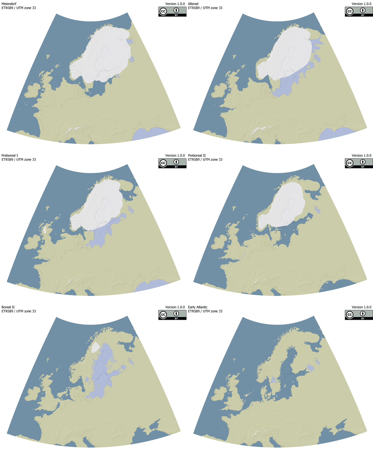
EPHA is a project of the Centre for Baltic and Scandinavian Archaeology (ZBSA) aiming to provide base maps for different prehistoric timeframes (see workgroup). While the maps are compilations from available literature and data, their main purpose is to act as overview maps. Thus incorporating and harmonizing existing data is the main purpose. The maps are prepared as vectorized and georeferenced files that are easily incorporated into Geo-Information Systems. All relevant information, like references or sources, are provided with the files so that the origin of data remains clear and citeable. Thus, easy and straightforward use is guaranteed. They are published under a Creative Commons license (CC-BY 4.0) for free use.
Each map is available in two versions:
1. vectorised shapefiles including landmasses, oceans, and ice shields
2. an overview of the source data.
The project is open for further refinement and contributions. Therefore we encourage colleagues to provide higher resolution data for certain areas or engage in discussions for improving the maps. Preferably we are interested in published maps.
Until we have established an open format for discussions, please get into contact with us by e-mail: sonja.grimm@zbsa.eu
EPHA is constantly in development and refinement. Hence it is highly recommended to note the version of a respective map used.
Since EPHA is a compilation from various sources, different copyrights may appear. Therefore it is mandatory to cite the respective literature if you use maps or parts of them. EPHA maps are licensed under the Creative Commons Attribution 4.0 International License (CC-BY 4.0). To view a copy of this license, visit https://creativecommons.org/licenses/by/4.0/
ZBSA
Ruth Blankenfeldt
Karin Göbel (project leader)
Sonja Grimm (project leader)
Daniel Groß (project leader)
Sascha Krüger
Jörg Nowotny
Markus Wild
Katja Winkler
external
Kay Krienke
Benjamin Serbe
These maps are currently available:
Last Glacial Maximum
Meiendorf
Allerød
Dryas III
Early Preboreal
Late Preboreal
Early Boreal
Late Boreal
Atlantic
The following datasets are also available:
- add the following timeslices:
- 7200 cal BC (Early Atlantic)
- 3500 cal BC
- 1000 cal BC
- 1 AD
- 1000 AD
- additional large lakes
- expand the map section further south
