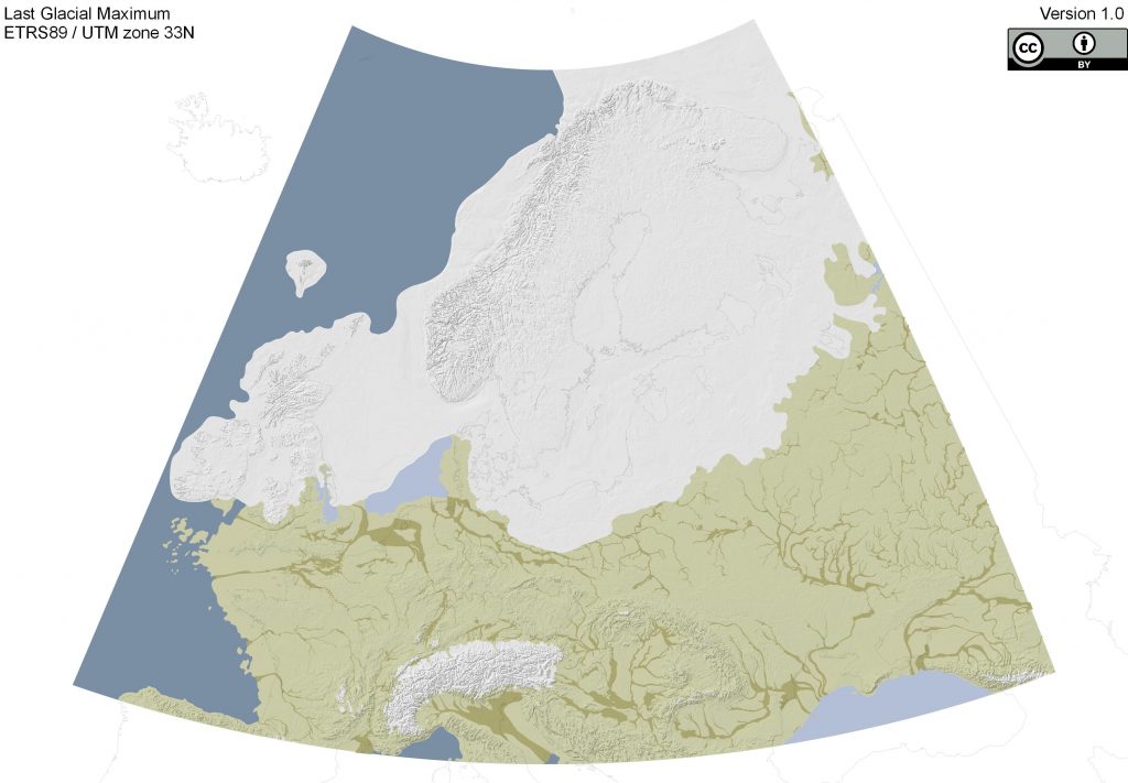
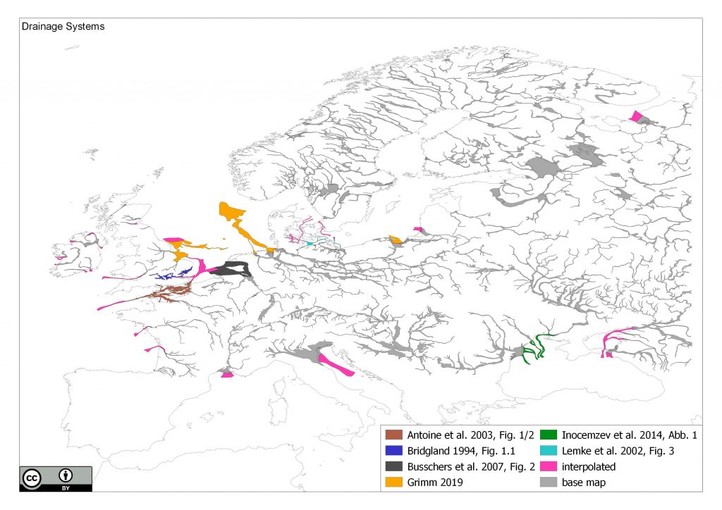
Drainage Systems
Version 1.0.0
Please cite this data as „compiled by ZBSA after Antoine et al. 2003; Bridgland 1994; Busschers et al. 2007; Grimm 2019; Inocemzev et al. 2014; Lemke et al. 2002“
For full references see below.
The map is approximately representing the timeslice:
| chronological frame | timeslice |
| Greenlandic isotope chronology | |
| years calibrated BC | 00–00 |
| year calibrated BP | 00–00 |
| 14C years BP | 00–00 |
This work is licensed under the Creative Commons Attribution 4.0 International License. To view a copy of this license, visit https://creativecommons.org/licenses/by/4.0/

The archive contains different files. We provide the Source SHP File with their secondary files, the „sources map“ PDF and the release notes PDF.
The SHP-files are meant to be used as additional layer for the EPHA maps to show valleys and potential prehistoric drainage systems.
The data bound is defined from 12°W to 44°E and 43°N to 72°N. All Data were digitalised from different sources (See Sources Map) which are listed further down in this site.
River valleys where digitised using the “European catchments and Rivers network system” (Ecrins) dataset provided by the European Environment Agency (https://www.eea.europa.eu/data-and-maps/data/european-catchments-and-rivers-network) and the elevation data of the “GEBCO One Minute Grid” from the “GEBCO Gridded bathymetric Data” (https://www.gebco.net/).
- River valleys where selected by the highest “maindrain”-attribute in the Ecrins dataset
- Dry valleys where reconstructed on topographic features
- Most interpolations are based on assumption and bathymetric features
| 29-08-2019 | 1st release of the data |
Antoine, P., Coutard, J.-P., Gibbard, P., Hallegouet, B., Lautridou, J.-P., Ozouf, J.-C. 2003: The Pleistocene rivers of the English Channel region. Journal of Quaternary Science 18(3), pp. 227-243
Bridgland, D.R. 1994: Quaternary of the Thames. Geological Conservation Review Series 7, Chapman and Hall, London, 441 pp.
Busschers, F.S., Kasse, C., van Balen, R.T., Vandenberghe, J., Cohen, K.M., Weerts, H.J.T, Wallinga, J., Johns, C., Cleveringa, P., Bunnik, F.P.M. 2007: Late Pleistocene evolution of the Rhine-Meuse system in the southern North Sea basin: imprints of climate change, sea-level oscillation and glacio-isostacy. Quaternary Science Reviews 26, pp. 3216-3248.
Grimm, S.B. 2019: Resilience and Re-organisation of Social Systems during the Weichselian Lateglacial in Northwest-Europe. An evaluation of the archaeological, climatic, and environmental records. Monographien des Römisch-Germanischen Zentralmuseum 128, Schnell & Steiner, Mainz, 662 pp.
Иноземцев, Ю.И., Ступина, Л.В., Тюленева, Н.В., Парышев, А.А., Маслаков, Н.А., Сидоренко, В.Б., Рыбак, Е.Н., Мельниченко, Т.А., Паславская, О.В. 2014: Палеогеография северо-западного шельфа Черного моря в голоцене [Paleogeography of the Northwestern Black Sea shelf during holocene], Географічні та геологічні науки 19(1), pp. 43-52.
Lemke, W., Jensen, J.B., Bennike, O., Endler, R., Witkowski, A., Kuijpers, A., 2002: Spät- und postglaziale Flüsse und Seen in der heutigen westlichen Ostsee. Greifswalder Geographische Arbeiten 26, pp. 73-77.

